Map Your Land.
Analyze Your Forest.
SilviCultural gives you the forestry mapping tools to manage your land from a whole different perspective. Use our array of high resolution imagery to see all dimensions of your forest, and break your forest into management units based on the observed forest conditions.
Full Mapping Features
Create Stands, Harvests, and Habitats
Hi-Res RGB, Multispectral, and LiDAR Imagery
Import and Export Imagery and Data
Easy-to-Use Professional Tools
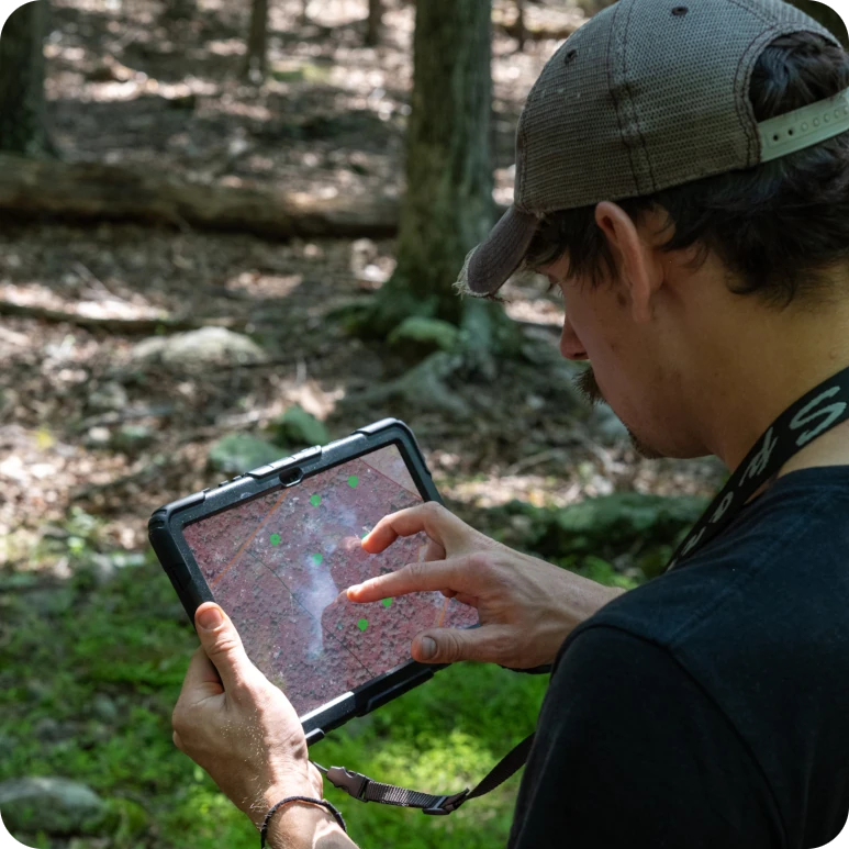
SilviCultural’s mapping software is easy and intuitive enough for complete beginners while having the tools, data, and capabilities of professional software. Analyze your forest from new perspectives only visible from state of the art remote sensing equipment, then carry your data out to the field for boots-on-the-ground analysis.
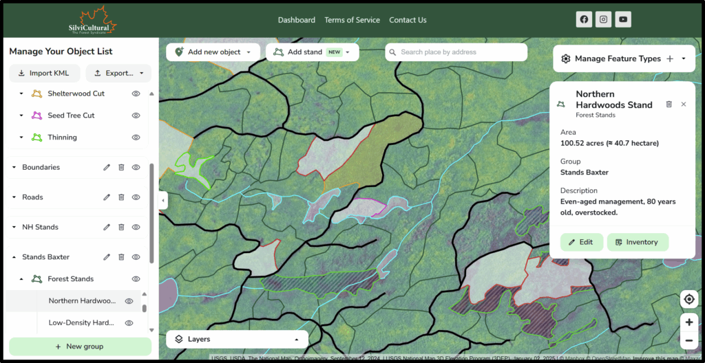
Delineate, Organize, and Analyze Your Land
Map Your property boundary. Break your forest into individual stands for scientific management. Create Future Plan future harvests and document past removals. delineate streams and layout trails. Everything you need to professionally organize your land is at your finger tips.
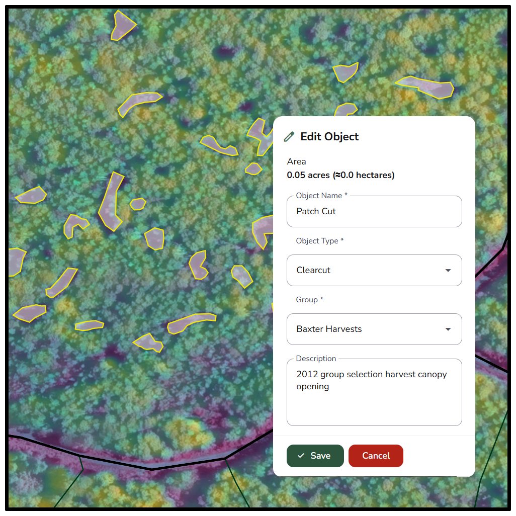
Create Harvests and Habitats on the Micro or Macro.
SilviCultural is suitable for properties large or small. Polygons can easily be created for entire forests thousands of acres of size, but the high-resolution imagery also allows for micro-management of isolated forest conditions, allowing you to manage your forest exactly according to your needs and objectives as a unique landowner.
Manage All Objectives
Suitable for All Management Objectives
Forest landowners are a diverse group of people, and so are their objectives and management styles. SilviCultural can be tailored to them all. Use our maps to analyze, delineate, and organize your land according to your needs.
Timber Management
Map stands of timber and organize them by species composition. Estimate volumes and project growth.
Wildlife Managment
Use multispectral imagery to identify critical habitat and use LiDAR data to map likely corridors.
Ecological Protection
Identify sensitive riparian zones, wetlands, and delineate them to protect them from harvest or other disturbances.
Recreation
Create trails, mark hunting stands, and export maps to give to stakeholders and lessees who use your land.
LiDar, multispectral, and remote sensing data
See Species, Health, Height, and Terrain All From Your Screen.
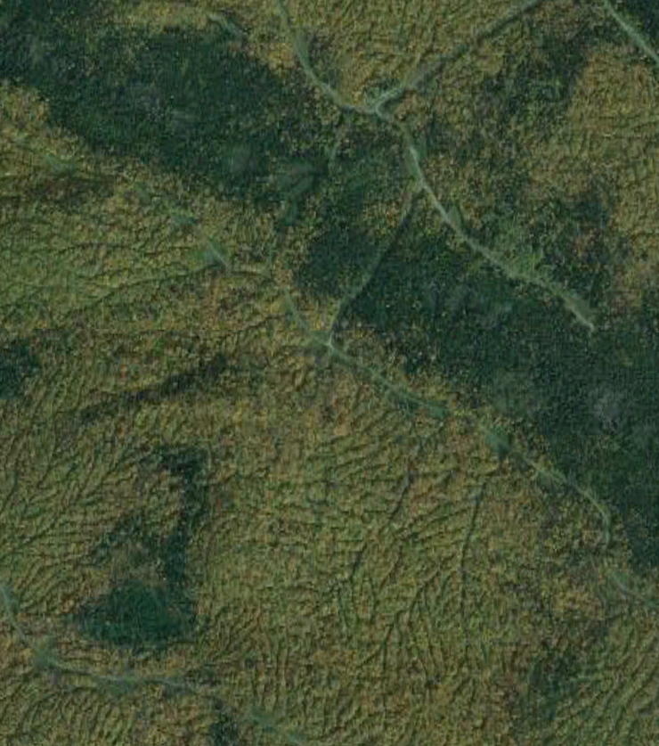
Standard RGB
Standard high resolution Red Green Blue satellite imagery for basic analysis and aerial image interpretation.
Color Infrared
Vegetation reflects far more infrared light than visible light, and so viewing the forest in CIR allows you to see more differences in species.
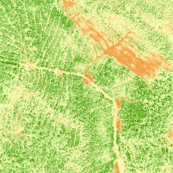
NDVI
The Negative Difference Vegetation Index shows the level of infrared reflectance, conveying information about the health of your forest foliage.
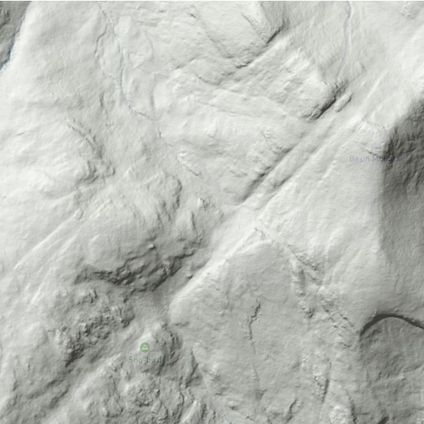
LiDAR Canopy Height
The canopy height model, derived from LiDAR-trained models, shows the height of your forest with a .59m resolution.
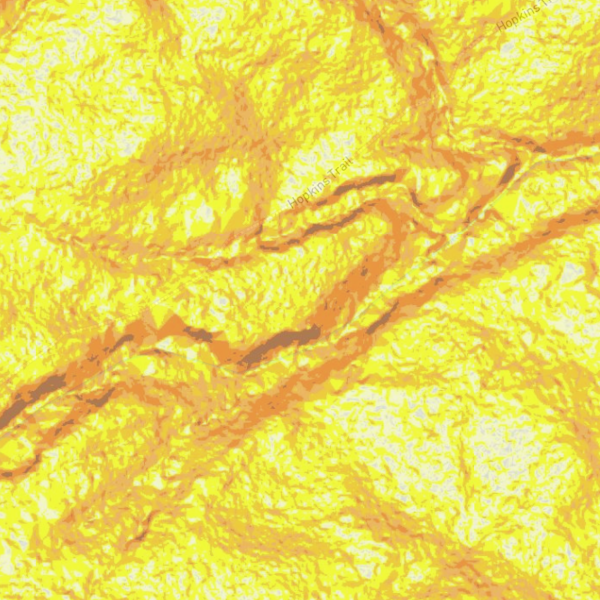
LiDAR Slope
Use LiDAR data to measure slope steepness to better plan trails and assess terrain difficulty and accessibility.
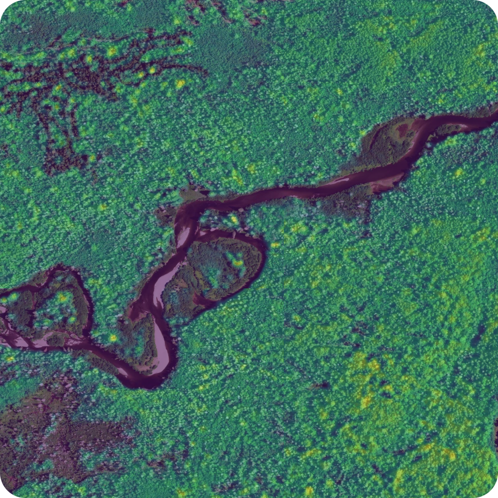
LiDAR Hillshade
Use the LiDAR hillshade model to see a high-resolution model of the earths surface and find stream beds, roads, and other fine details.
Download Unlimited Maps and Imagery to Use Out in the Field.
SilviCultural data can be readily downloaded as a georeferenced TIFF file to be used in many GPS platforms, including most cellphone GPS apps. Imagery can also be downloaded and used with other GIS platforms.
Cross-Compatible With Most Popular GPS Systems


Export Your Data To Use Anywhere or Import Old Data to Migrate Over
SilviCultural works with KML files for lines, points, and polygons and GeoTIFF for imagery, giving it complete or partial compatibility with a range of other mapping and GPS platforms as well as professional GIS software.
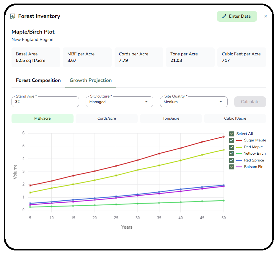
Save Inventory and Growth Data to Your Polygons
With SilviCultural’s inventory tools, you can collect data in the field and plug it in to your polygons to generate inventory estimates and project growth over the next 50 years.
Join Now and Steward Your Land
Level-Up Your ForestPer Year
One-Time Payment
Explore the features
Forestry Mapping and Imagery
Precision mapping for your forest.

Forest Growth and Inventory
Determine timber volumes and growth trajectories
Tools and Research
Plan sustainable harvests, get AI forestry advice, and more.