Skip to content
SilviCultural
  • Home
  • Pricing
  • Mapping
  • Cruising & Inventory
  • Management Plans
  • Terms of Service
  • Contact Us
Facebook Instagram YouTube
Login
SilviCultural
  • Understanding Color Infrared Imagery for Forest Management
    Mapping

    Understanding Color Infrared Imagery for Forest Management

    ByZachary Lowry October 22, 2025October 22, 2025

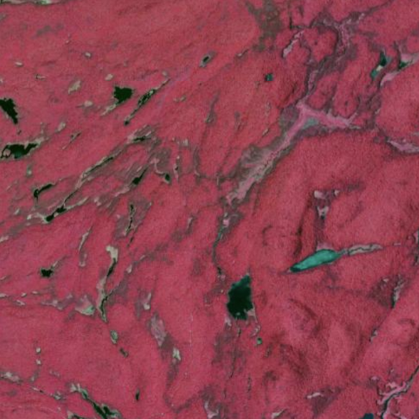
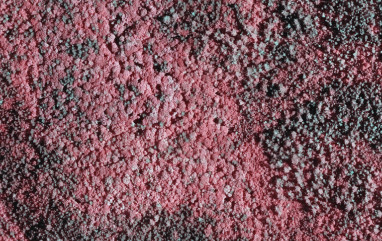
    If you’ve been exploring the imagery tools in SilviCultural, you’ve probably noticed something striking: your forest doesn’t look like a forest. Instead of the familiar greens and browns, healthy trees appear in vibrant shades of red and pink, while stressed vegetation shows up as pale or even cyan. This isn’t a glitch in the software—it’s…

    Read More Understanding Color Infrared Imagery for Forest ManagementContinue

  • Phone GPS accuracy
    GPS

    How Accurate Are Phone GPS Systems?

    ByZachary Lowry October 22, 2025October 22, 2025

    If you’ve ever wondered how accurate are phone GPS receivers, you’re not alone. Modern smartphones have become essential navigation tools for everything from daily commutes to outdoor adventures, and you can use them to leverage SilviCultural’s GeoTIFF export capabilities, but understanding their precision capabilities is crucial for knowing when you can rely on them. Understanding…

    Read More How Accurate Are Phone GPS Systems?Continue

  • October 2025 Market Report: Lumber Markets Face Perfect Storm
    News

    October 2025 Market Report: Lumber Markets Face Perfect Storm

    ByZachary Lowry October 21, 2025October 21, 2025

    The North American lumber market entered a critical inflection point in October 2025 as combined tariffs exceeding 45% on Canadian softwood lumber collided with aggressive production curtailments and recovering prices. After months of weakness, lumber futures climbed to $610 per thousand board feet by October 20, up 16.18% year-over-year, while the Madison’s Lumber Index surged…

    Read More October 2025 Market Report: Lumber Markets Face Perfect StormContinue

  • What is a GeoTIFF? How to Get the Most Out of SilviCultural.
    GPS | Mapping

    What is a GeoTIFF? How to Get the Most Out of SilviCultural.

    ByZachary Lowry October 21, 2025October 22, 2025

    SilviCultural let’s you export your maps and imagery into a GeoTIFF format. But what exactly is a GeoTIFF, and why does it matter for your forest management workflow? Understanding this powerful file format can unlock new capabilities for analyzing your property, planning operations, and integrating data across different software platforms. In this guide, we’ll demystify…

    Read More What is a GeoTIFF? How to Get the Most Out of SilviCultural.Continue

  • Sustainable Harvesting: Understanding Area Control vs. Volume Control Methods
    Harvesting

    Sustainable Harvesting: Understanding Area Control vs. Volume Control Methods

    ByZachary Lowry October 19, 2025October 19, 2025

    For woodland owners who want to generate income from their forest while ensuring it remains healthy and productive for future generations, sustainable harvesting is the foundation of responsible forest management. But what does “sustainable” actually mean in practice, and how do you calculate how much timber you can safely harvest each year? The answer lies…

    Read More Sustainable Harvesting: Understanding Area Control vs. Volume Control MethodsContinue

  • forest stands
    Mapping

    What Are Forest Stands? A Complete Guide to Forest Stand Identification and Management

    ByZachary Lowry October 19, 2025October 21, 2025

    If you own woodland property or are interested in forest management, you’ve likely encountered the term “forest stand.” But what are forest stands, exactly, and why do they matter for effective woodland stewardship? Whether you’re managing ten acres or ten thousand, understanding forest stands is essential for maximizing the ecological and economic value of your…

    Read More What Are Forest Stands? A Complete Guide to Forest Stand Identification and ManagementContinue

  • NEW FEATURE: Cruising & Inventory Tool
    Uncategorized

    NEW FEATURE: Cruising & Inventory Tool

    ByZachary Lowry May 1, 2025

    We have just released a new feature that many of you have been waiting for – a comprehensive cruising and inventory tool. This powerful addition allows you to gather and analyze forest data directly within the platform’s ecosystem, providing valuable insights for management decisions. What Can the Tool Do? The cruising and inventory program allows…

    Read More NEW FEATURE: Cruising & Inventory ToolContinue

  • NEW: US Infrared and LiDAR Layers Now Available
    Uncategorized

    NEW: US Infrared and LiDAR Layers Now Available

    ByZachary Lowry April 1, 2025April 1, 2025

    Forest management in today’s world requires precision, insight, and the ability to see beyond what’s visible to the naked eye. We’re excited to announce the addition of four powerful new data layers to our mapping application: Color Infrared (CIR) imagery, Normalized Difference Vegetation Index (NDVI), LiDAR hillshade, and LiDAR slope visualization, all available for the…

    Read More NEW: US Infrared and LiDAR Layers Now AvailableContinue

  • NEW FEATURE: Harvest Planning Tool
    Uncategorized

    NEW FEATURE: Harvest Planning Tool

    ByZachary Lowry January 15, 2025January 16, 2025

    A key aspect of sustainable and practical forest management is developing a system to allow for consistent harvesting without reducing standing inventory or timber sizes and values over time. While many solutions exist, ranging from condition-based ad hoc management to growth-based harvest allowances, they come with substantial drawbacks or remain out of reach to the…

    Read More NEW FEATURE: Harvest Planning ToolContinue

  • How to Export Your Maps to Use in the Field
    Uncategorized

    How to Export Your Maps to Use in the Field

    ByZachary Lowry August 25, 2024August 25, 2024

    Using SilviCultural’s GIS Mapping program, you can export maps into GeoTIFF files to use to navigate and collect data out in the field, even when you don’t have any signal. All you need is a GPS-capable mobile device and a special app. Here is a quick tutorial on how to do that. 1. Export Your…

    Read More How to Export Your Maps to Use in the FieldContinue

© 2025 SilviCultural

  • Terms of Service
  • Blog
  • Login
  • Home
  • Pricing
  • Mapping
  • Cruising & Inventory
  • Management Plans
  • Terms of Service
  • Contact Us