What is a GeoTIFF? How to Get the Most Out of SilviCultural.
SilviCultural let’s you export your maps and imagery into a GeoTIFF format. But what exactly is a GeoTIFF, and why does it matter for your forest management workflow? Understanding this powerful file format can unlock new capabilities for analyzing your property, planning operations, and integrating data across different software platforms.
In this guide, we’ll demystify GeoTIFFs, explore their technical foundations, and show you how they enable seamless data sharing between mapping applications, GPS devices, and Geographic Information Systems (GIS). We’ll also explain how SilviCultural’s GeoTIFF export functionality puts professional-grade mapping capabilities in your hands.
What is a GeoTIFF?
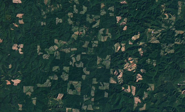
A GeoTIFF is simply a TIFF image file that contains embedded geographic information. The name combines “geo” (for geographic) with “TIFF” (Tagged Image File Format), describing exactly what it is: a standard image format enhanced with spatial reference data.
Here’s what makes GeoTIFFs special: while a regular TIFF file is just a picture with no inherent understanding of where on Earth it represents, a GeoTIFF knows exactly where it belongs. It contains metadata that tells software applications the real-world coordinates of every pixel in the image, allowing that image to be accurately positioned on a map or globe.
Think of it this way: a regular photograph of your forest is like a puzzle piece without any edge information—you know what it shows, but you don’t know where it fits in the larger picture. A GeoTIFF is like that same puzzle piece with coordinates written on the back, allowing you to place it precisely in the correct location every time.
The Technical Foundation: How GeoTIFFs Store Location Information
Understanding how GeoTIFFs work requires a brief dive into the technical details. Don’t worry—we’ll keep it practical and focused on what matters for forest management applications.
Coordinate Reference Systems
Every GeoTIFF is tied to a specific coordinate reference system (CRS), which defines how positions on Earth’s curved surface are translated to flat map coordinates. Common coordinate systems include:
Geographic Coordinate Systems: Using latitude and longitude (like GPS coordinates), measured in degrees. For example, WGS84 is the coordinate system used by GPS satellites.
Projected Coordinate Systems: Using X and Y coordinates measured in feet or meters from a defined origin point. In the United States, State Plane coordinate systems and UTM (Universal Transverse Mercator) are common. These systems minimize distortion within specific geographic regions.
The GeoTIFF standard supports virtually any coordinate reference system, ensuring that imagery can be accurately positioned whether you’re working in Alabama or Alaska, using feet or meters, with State Plane or UTM coordinates.
Embedded Georeferencing Metadata
Inside every GeoTIFF file, embedded tags contain the critical georeferencing information:
Transformation Matrix: Defines how pixel coordinates (row and column numbers in the image) translate to real-world coordinates. This matrix encodes the image’s position, scale, and rotation.
Coordinate System Definition: Specifies which coordinate reference system the coordinates use, including the datum (the mathematical model of Earth’s shape), projection parameters, and units of measurement.
Pixel Scale: Defines the ground distance represented by each pixel—for example, each pixel might represent 1 meter by 1 meter on the ground. This is your image resolution in real-world units.
Tie Points: Reference coordinates that anchor the image to known positions. These ensure the image aligns perfectly with other spatial data.
This metadata is embedded directly in the TIFF file structure using standard tags, meaning the geographic information travels with the image file. You don’t need separate “world files” or auxiliary metadata files—everything is self-contained in a single file.
Projection and Datum Information
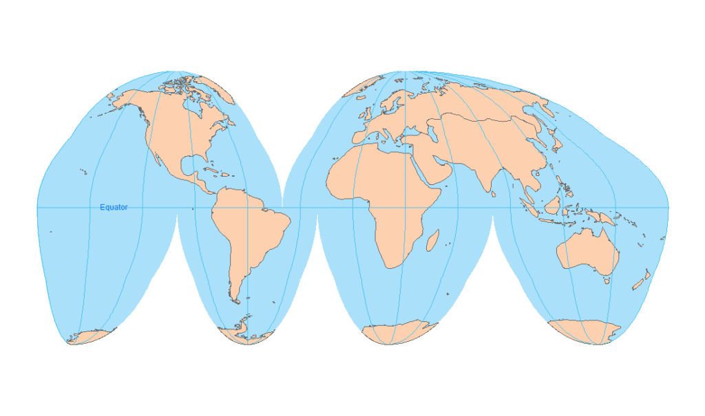
GeoTIFFs also store detailed information about map projections and datums. This might seem esoteric, but it’s crucial for accurate mapping:
Datum: Defines the mathematical model of Earth’s shape and size. Common datums include NAD83 (North American Datum of 1983) and WGS84 (World Geodetic System 1984). Using the wrong datum can cause position errors of tens of meters or more.
Projection: Defines how the curved Earth surface is flattened into a 2D map. Different projections preserve different properties (angles, areas, distances), and choosing the appropriate projection for your region minimizes distortion.
Because all this information is embedded in the GeoTIFF, any GIS software or GPS program that opens the file automatically knows how to position and display it correctly, ensuring compatibility across platforms.
Why GeoTIFFs Matter for Forest Management
For woodland owners and land managers, GeoTIFFs provide several critical advantages over regular image files:
Accurate Spatial Analysis
When you open a GeoTIFF in GIS software, it automatically aligns with your property boundaries, stands, roads, streams, and other spatial data. This allows you to:
- Measure accurate distances and areas directly on the imagery
- Overlay imagery with GPS tracks from field navigation
- Identify exact coordinates for features you see in the image
- Combine multiple GeoTIFF layers (like SilviCultural’s CIR imagery and LiDAR visualizations) with perfect alignment
Integration with GPS Devices
Many handheld GPS units and mobile GPS applications can display GeoTIFF images as background maps. This enables you to:
- Navigate to specific locations you’ve identified in office planning
- Mark waypoints on imagery while in the field
- See real-time position overlaid on high-resolution imagery
- Orient yourself in complex terrain by matching ground conditions to image features
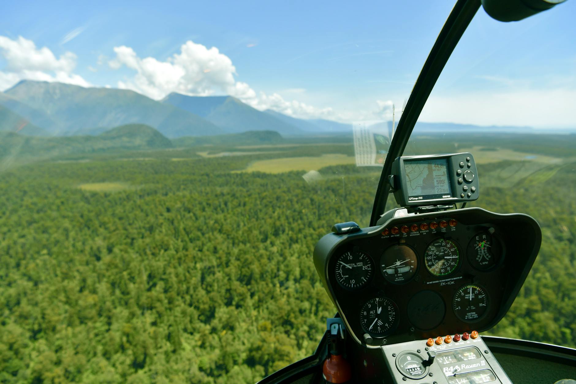
Modern forestry GPS units from manufacturers like Garmin and Trimble support GeoTIFF loading, turning your device into a powerful navigation tool with your own custom imagery.
Cross-Platform Compatibility
Because GeoTIFF is an open, standardized format, files work seamlessly across different software platforms:
- Desktop GIS: ArcGIS, QGIS, and other professional GIS applications read GeoTIFFs natively
- CAD Software: AutoCAD and similar programs can import GeoTIFFs for design work
- GPS Applications: Avenza Maps, Gaia GPS, and other mobile apps display GeoTIFF backgrounds
- Cloud Platforms: Google Earth Pro and other web-based tools accept GeoTIFF uploads
- Forestry Software: Specialized forestry programs integrate GeoTIFF imagery for cruise planning and analysis
This interoperability means you can export a GeoTIFF from one platform, share it with a consultant or contractor, and know they’ll see exactly the same positioned imagery you see.
Professional Documentation
GeoTIFFs provide professional-quality documentation of your property:
- Create high-resolution, accurately scaled maps for forestry plans
- Generate exhibits for conservation easements or timber sales
- Document conditions before and after management activities
- Share imagery with consulting foresters, loggers, or appraisers
The embedded georeferencing ensures anyone opening your file sees accurate, map-scale imagery without manual alignment or guesswork.
Using GeoTIFFs in GIS Software
Geographic Information Systems (GIS) are the primary environment where GeoTIFFs shine. Here’s how GeoTIFFs integrate into GIS workflows:
Basemap Layers
GeoTIFFs serve as basemap imagery that provides visual context for other data layers. You might overlay property boundaries, harvest units, road networks, or wildlife observations on top of GeoTIFF imagery, creating comprehensive maps that combine field data with aerial perspectives.
Raster Analysis
GIS software can perform sophisticated analysis on GeoTIFF data. For forestry applications, this includes:
- Image classification: Automatically identifying forest types, clearings, or disturbances
- Change detection: Comparing GeoTIFFs from different years to identify harvest areas, regeneration, or damage
- Terrain analysis: When using LiDAR-derived GeoTIFFs, calculating slope, aspect, and topographic features
- Viewshed analysis: Determining visibility from observation points
Coordinate Transformation
Modern GIS software can automatically transform GeoTIFFs between different coordinate systems. If you receive imagery in one projection but need to work in another, the software uses the embedded coordinate information to reproject the data accurately.
Integration with Vector Data
GeoTIFFs (raster data) combine seamlessly with vector data (points, lines, and polygons). You can digitize stand boundaries while viewing GeoTIFF imagery, snap GPS tracks to image features, or validate timber cruise plots against imagery—all with perfect spatial alignment.
Using GeoTIFFs with GPS Applications
Beyond desktop GIS, GeoTIFFs enable powerful field navigation capabilities when loaded into GPS devices and mobile applications:
Mobile GPS Apps
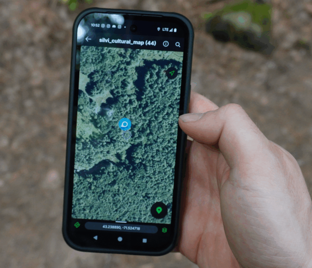
Applications like Avenza Maps, Gaia GPS, and OnX Maps allow you to load custom GeoTIFF imagery as offline maps. This is invaluable for forest navigation where cellular coverage is unreliable. You can:
- Pre-load high-resolution imagery of your property
- Navigate without internet connectivity
- Mark waypoints for trees, plot centers, or features of interest
- Record GPS tracks of roads, trails, or stand boundaries
Handheld GPS Units
Professional forestry GPS units can display GeoTIFF imagery, combining accurate GPS positioning with detailed visual context. This helps you:
- Navigate to pre-planned timber cruise plots
- Relocate boundary corners or monuments
- Identify landscape features before reaching them
- Verify you’re in the correct stand or harvest unit
Field Data Collection
When field crews use GPS devices with GeoTIFF backgrounds, data quality improves dramatically. They can see exactly where they are relative to stand boundaries, prior harvest areas, and terrain features, reducing positional errors and ensuring data is attributed to the correct locations.
SilviCultural’s GeoTIFF Export Capabilities
Understanding what GeoTIFFs are and why they matter is one thing—actually getting them for your property is another. This is where SilviCultural’s export functionality becomes invaluable.
SilviCultural allows you to export GeoTIFFs of both imagery and maps directly from the platform. This means you can take the powerful CIR imagery, LiDAR visualizations, and custom maps you create in SilviCultural and use them anywhere you need them:
Export to Field GPS: Download GeoTIFFs of your property and load them onto handheld GPS units for field navigation with your own custom imagery as the background.
Import to Desktop GIS: Export SilviCultural imagery and open it in professional GIS software like QGIS or ArcGIS for advanced analysis, custom map creation, or integration with other datasets.
Share with Contractors: Provide logging contractors, consulting foresters, or land management professionals with accurately georeferenced imagery of your property, ensuring everyone is literally looking at the same picture.
Archive Management Records: Save GeoTIFFs documenting your property conditions before and after management activities, creating a permanent visual record tied to specific dates and locations.
Mobile Field Use: Load exported GeoTIFFs into mobile GPS apps on your smartphone or tablet, turning your device into a navigation tool with professional-quality aerial imagery.
The GeoTIFF files exported from SilviCultural contain all the necessary coordinate system information, ensuring they display correctly in any GIS or GPS application without manual georeferencing or adjustment. This professional-grade capability, once available only through expensive software and specialized expertise, is now accessible with a simple export function.
Technical Considerations When Working with GeoTIFFs
While GeoTIFFs are relatively user-friendly, a few technical considerations help ensure smooth workflows:
File Size
High-resolution GeoTIFFs can be large for an image file. SilviCultural’s exports tend to be around 25MB in size. This is normal and reflects the detailed information they contain. Be prepared with adequate storage and understand that file transfers may take time.
Compression
GeoTIFFs can use compression to reduce file size while preserving image quality. Common compression methods include LZW (lossless) and JPEG (lossy). SilviCultural optimizes compression to balance file size with image quality for typical forestry applications.
Coordinate System Matching
For best results, try to work in consistent coordinate systems across all your spatial data. While GIS software can transform between systems, keeping everything in the same coordinate system (like your state’s State Plane coordinate system) simplifies workflows and minimizes potential errors.
Software Compatibility
While the GeoTIFF standard is widely supported, some older or simplified software may have limited capabilities. Professional GIS software and modern GPS applications handle GeoTIFFs without issue, but it’s worth verifying compatibility if you’re using specialized or older programs.
Conclusion
GeoTIFFs are more than just images—they’re sophisticated spatial data files that bridge the gap between visual information and geographic analysis. By embedding coordinate system information directly into image files, GeoTIFFs enable accurate mapping, seamless data integration, and powerful spatial analysis.
For forest landowners and managers, GeoTIFFs unlock professional capabilities: navigating with custom imagery on GPS devices, performing analysis in GIS software, sharing accurately positioned data with contractors and consultants, and maintaining comprehensive documentation of property conditions.
SilviCultural’s GeoTIFF export functionality puts these capabilities at your fingertips. Whether you’re planning a timber harvest, navigating to plot locations, creating management maps, or analyzing forest conditions, the ability to export and use georeferenced imagery in industry-standard formats empowers you to manage your woodland with the same tools and precision available to large forestry operations.
The next time you need to share imagery, navigate in the field, or perform spatial analysis, remember that GeoTIFF export from SilviCultural gives you the professional-grade data format you need—complete with all the embedded geographic information that makes it work seamlessly across platforms and applications.