Forest management for the average landowner
SilviCultural is the leading forestry mapping software and management tool made for the everyday forest landowner. Our professional-grade tools combine mapping with inventory and growth estimation and AI forestry advice to give you everything you need to take charge of your land management.

Forest Mapping and Inventory Software For Everyone
Whether you are an expert or novice, get the most out of your land and manage it like the intergenerational treasure it is.
Forestry Mapping Software With Comprehensive Tools
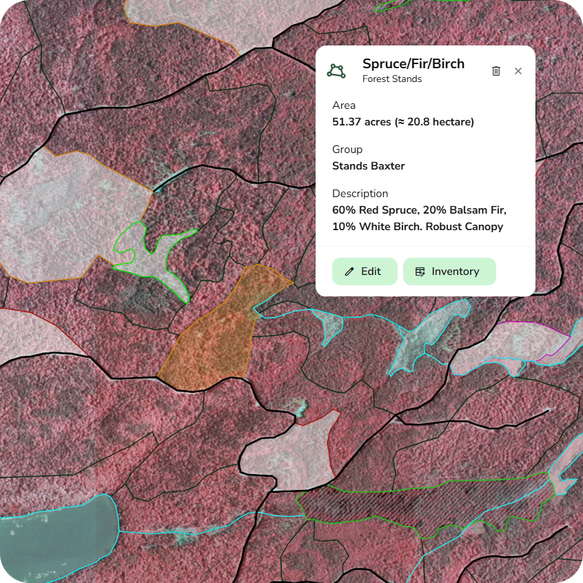
Create polygons, line, and waypoints, import and export KMLs, and create a map of your forest to document boundaries, stands, harvests, habitats, and more.
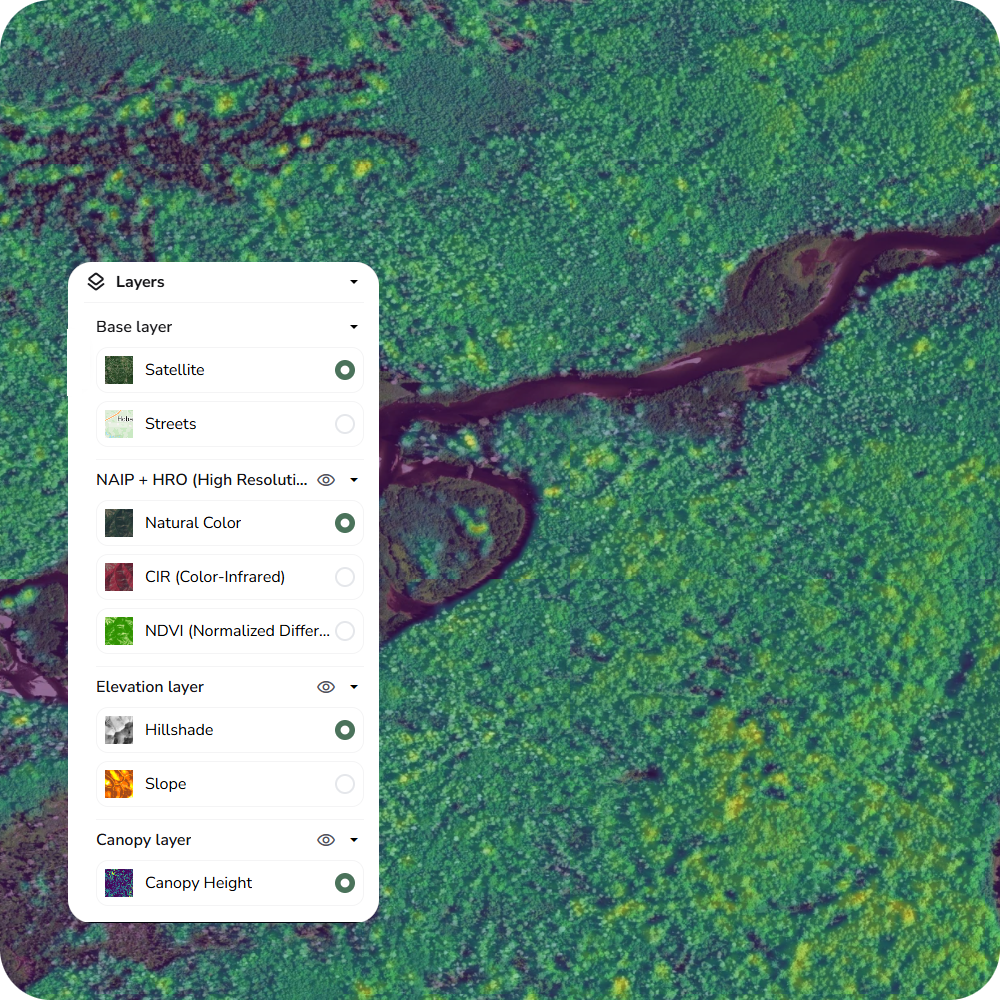
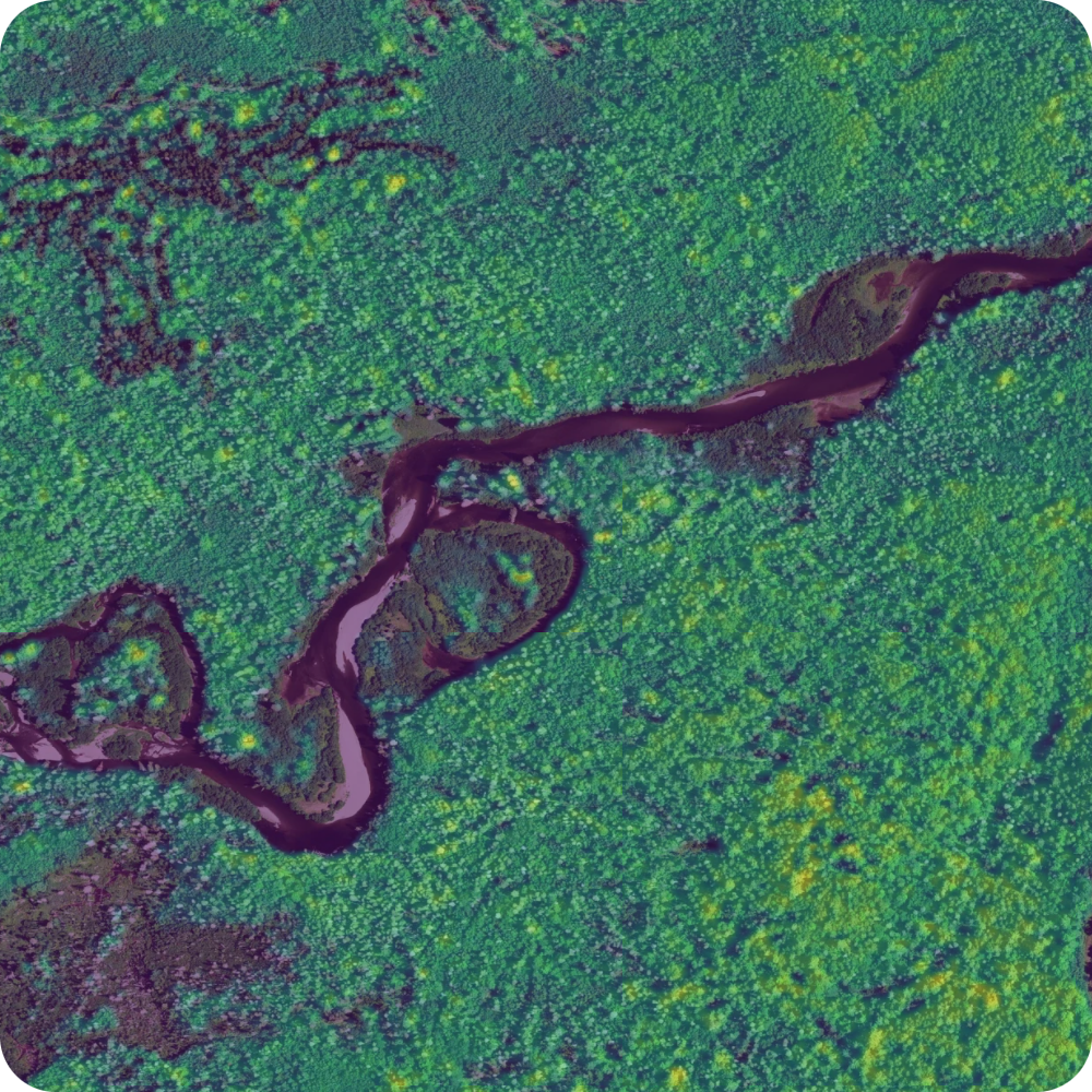
Forest Analysis With High-Resolution Multispectral and LiDAR Imagery
Differentiate species and determine foliage health with high color infrared and NVDI imagery. Use LiDAR hillshade and slope models to see the earth’s surface in extreme detail and determine steep slopes on your property to find trail and harvest routes.
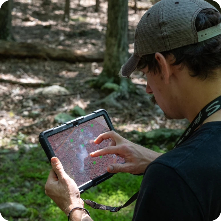
Offline Export and GPS/GIS Integration For Use in the Field
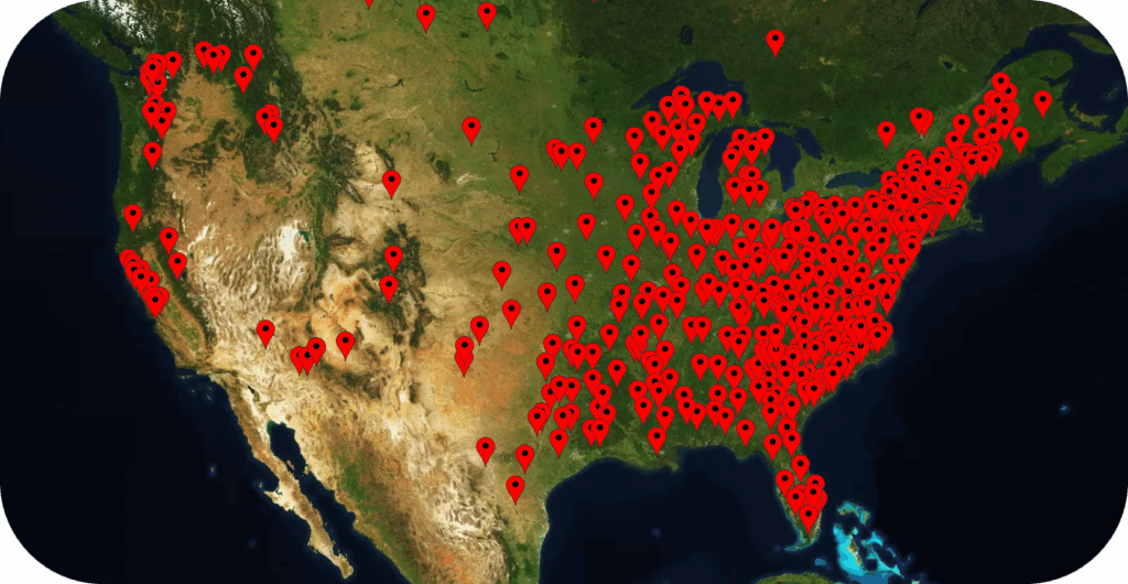
Export all your imagery and features as a high-resolution Geo-referenced file to use with your phone’s GPS or a wide array of GPS and GIS systems. Use it to collect more data, send them to lessees or contractors, or use them recreationally for any land in the US.
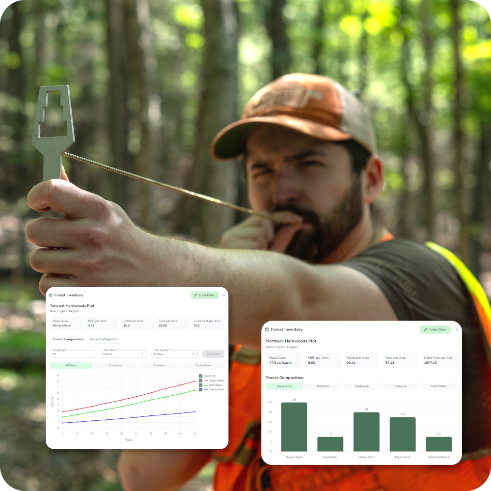
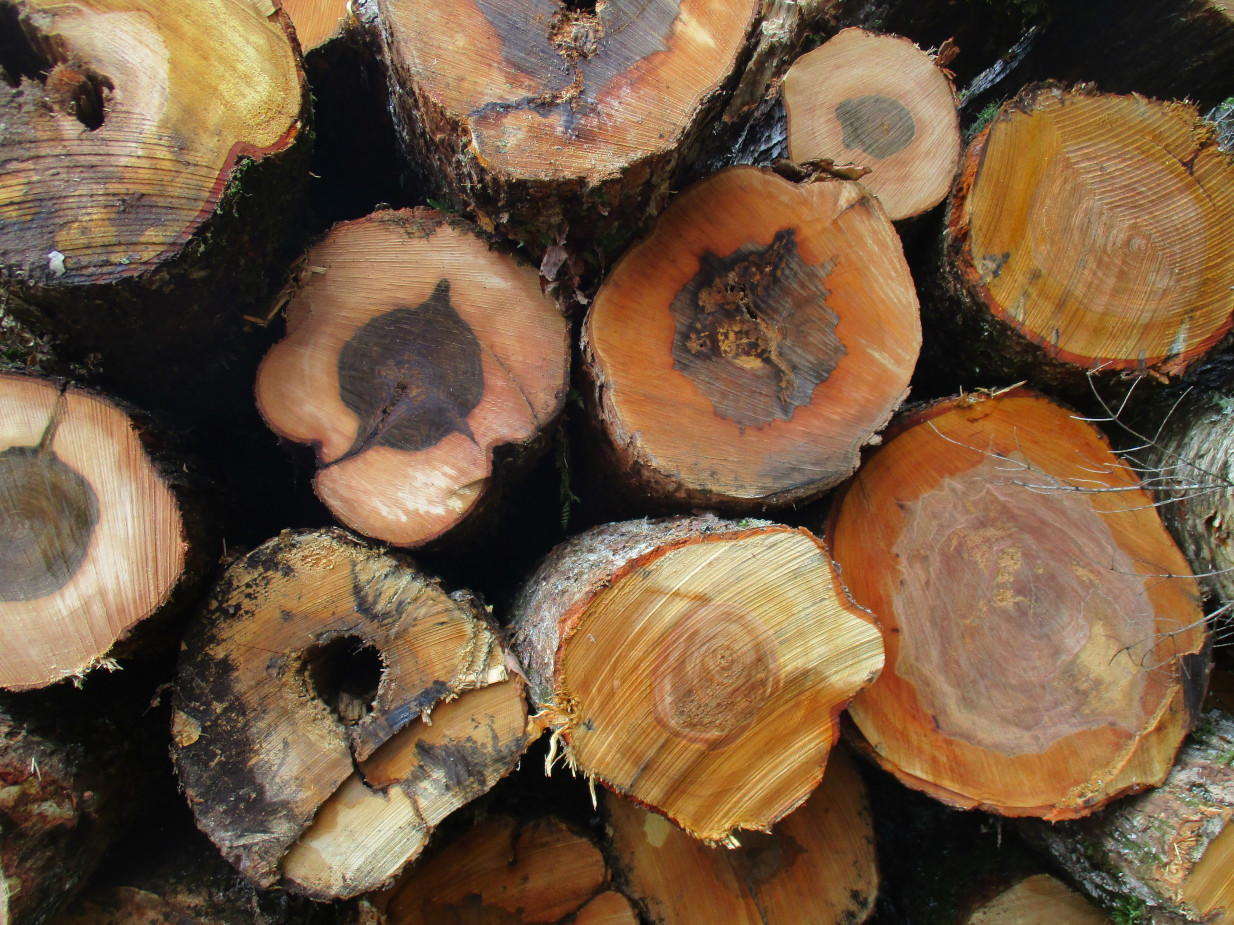
Estimate Your Forest Inventory and Project Growth With Easy-to-Use Tools
Use Your SilviCultural-supplied tools to take simple data points on your land to generate standing volume estimates, calculated from species and region-specific variables. Project out the growth of your stands 50 years to see how it will grow.
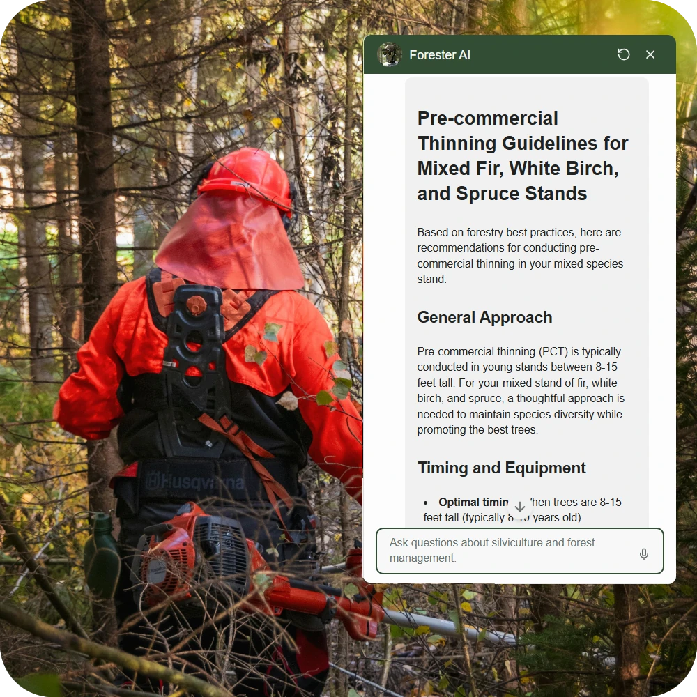
Build a Sustainable Forest Management Plan and Get Expert AI Forestry Advice
Use your data to determine an actionable annual harvest allowance to ensure you can get consistent yields from your forest in perpetuity. Use our custom Forester AI trained on scientific and technical forestry materials to get the best and most relevant information possible.
Cross-Compatible With Most Popular GPS Systems


A Full Suite of Forestry Tools and Resources
Whether you are experienced or brand new to the concept of forest management, SilviCultural is the all-in-one forest mapping software.
Imagery and Remote Sensing Data
Mapping Features
Cruising and Inventory
Forestry Tools and Research
Explore the features
Forestry Mapping and Imagery
Precision mapping for your forest.

Forest Growth and Inventory
Determine timber volumes and growth trajectories
Tools and Research
Plan sustainable harvests, get AI forestry advice, and more.

“The imagery alone is worth it. I used to scroll Google Earth for fun, but now I open up SilviCultural and explore”
“I got more from this platform in one month than I got from the county forestry office in two decades”
“I have a forester I’ve been working with, and having my land already mapped out working out prescriptions with the AI has made the process so much easier”
60 Day Money-Back Guarantee
Try SilviCultural risk free. If you don’t like it, we’ll issue you a full refund for up to 60 days after purchase, no returns necessary.
Join Now and Steward Your Land
Level-Up Your ForestPer Year
One-Time Payment
What Would It Cost to Hire a Forester?
While SilviCultural cannot completely replace traditional forestry services, it is a tremendous complement to them. For smaller landowners priced out of traditional services, SilviCultural can save you thousands and give you management capabilities previously unobtainable.
|
PRICE COMPARISON: |
Forestry Consultant $3,800 |
SilviCultural $65 |
|---|---|---|
|
$800 | ||
|
$1,200 | ||
|
$500 | ||
|
$700 | ||
|
$600 |
Empower Your Forest Management With SilviCultural
Sign up for SilviCultural and take control of your forest.